Interactive map: new cycle paths for a deconfinement by bike
For simpler and safer cycling trips
Alternative forms of mobility such as cycling are in the spotlight with the end of lockdown: in addition to offering many a viable alternative to public transport or the car in terms of travel time, cycling allows people to travel while respecting barrier measures to limit the spread of the virus.

Thus, to encourage the use of bicycles by Ile-de-France residents following the end of lockdown, temporary cycle paths have been set up. While some of these paths were able to be used by cyclists from 11 May, this network will be deployed more widely from 18 May with nearly 50 kilometres of additional paths, then nearly 150 kilometres in June. More than a temporary measure, this measure also has the role of laying the groundwork for a more massive and sustainable development of the use of bicycles in Île-de-France.
To help you pedal safely, an interactive map is now available on the Smart Services website of the Île-de-France Region. The latter will allow you to find permanent and temporary cycling facilities for as well as many other services (repairers, bicycle parking, etc.).
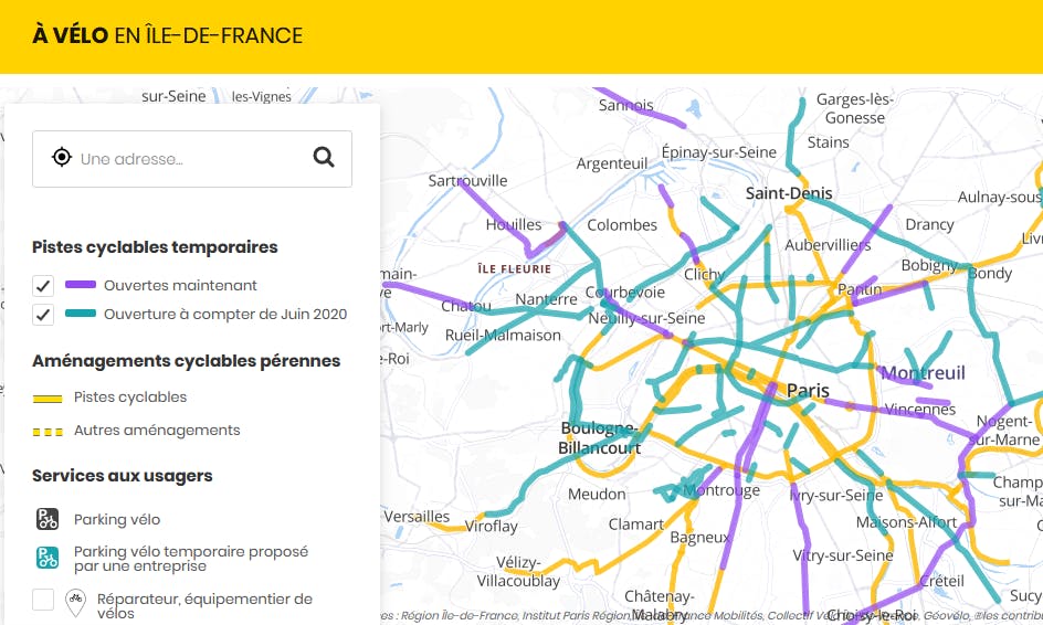
Visual of the interactive map showing the temporary tracks
Measures have also been implemented by Île-de-France Mobilités to promote the use of bicycles in the Île-de-France region: