RedevelopmentPôle gare Le Bourget-Drancy
Discover the project
Proposed developments
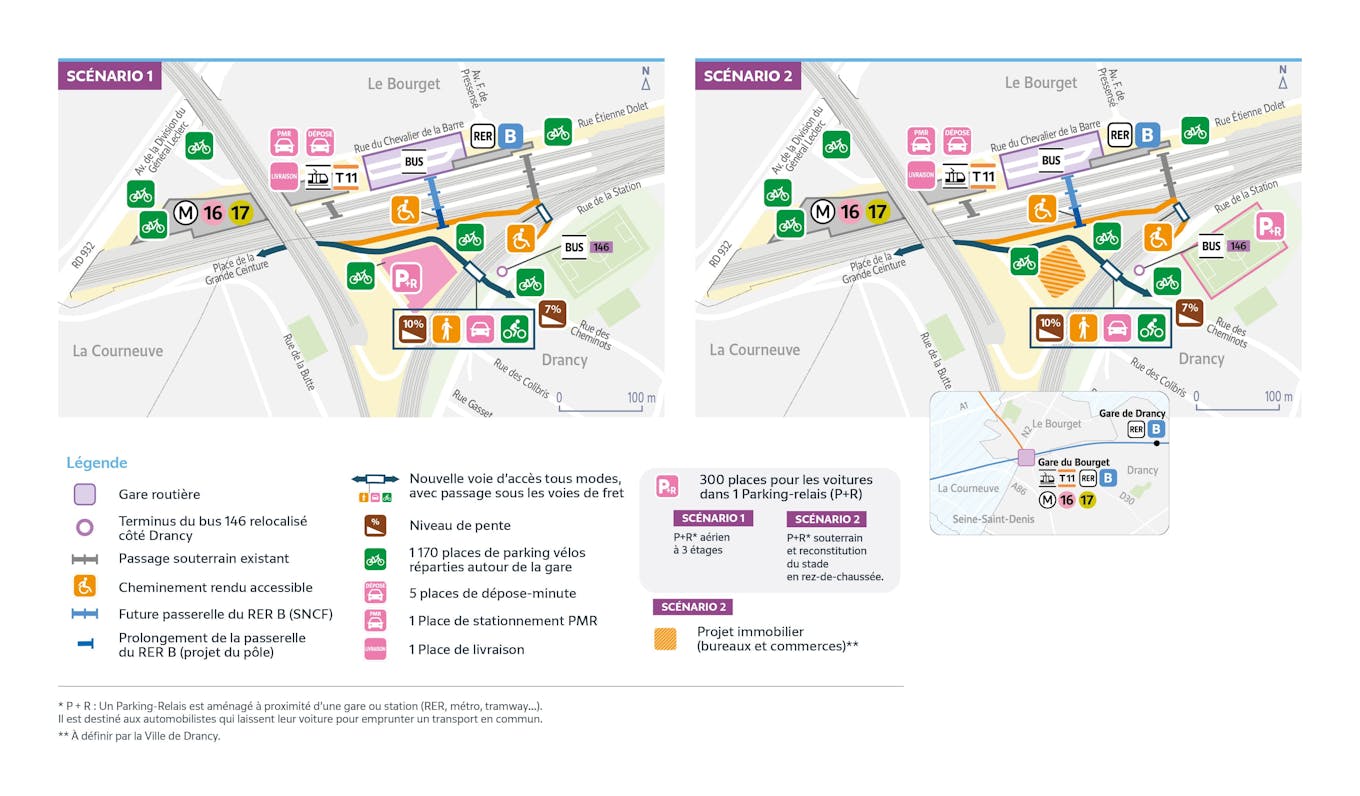
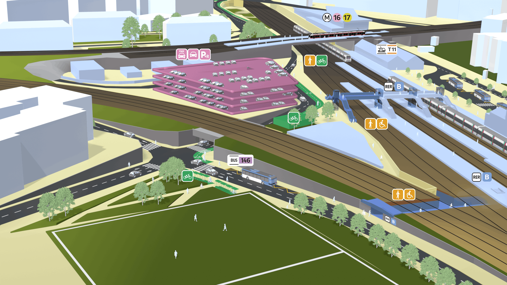
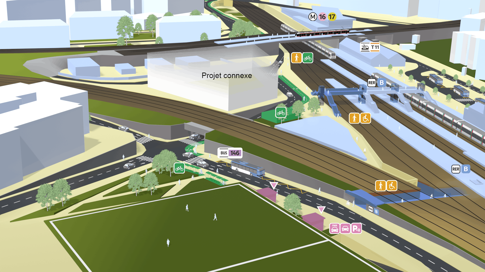
Maps showing the two scenarios envisaged for the project to redevelop the Le Bourget-Drancy station, at the level of the current Le Bourget station. The station serves the RER B, the T11 Express, bus lines, and tomorrow, the new metro lines 16 and 17. The maps show the developments to improve the accessibility of the station to pedestrians, PRMs and bus users and to strengthen access to the station for motorists.
The project provides for several developments to improve the accessibility of the station to all users from Drancy, whoever they are, pedestrians, PRM, bus users or motorists continuing their journey by public transport:
Mise en accessibilité
a path from the rue de la station in Drancy to cross the railway tracks and reach the Place de la Grande Ceinture
Prolongement d’une nouvelle passerelle
accessible to passengers to cross the RER B tracks and reach the station from the Place de la Grande Ceinture in Drancy
Relocalisation du terminus de la ligne de bus 146
south of the station, rue de la Station
Création de 1 170 places de parkings vélos
on either side of the railway tracks, Place de la Grande Ceinture in Drancy, in the immediate vicinity of the entrances to the RER B and then the M16 and 17 at Le Bourget
Création d’une nouvelle voie d’accès
passing under the railway tracks (freight) for all modes between the rue des cheminots and the Place de la Grande Ceinture (motorists, pedestrians and cyclists)
Finally, the project provides for the creation of a park-and-ride (P+R) with 300 spaces, intended for motorists coming to use public transport.
Two scenarios are proposed for the establishment of this park-and-ride:
Scenario 1
Three-storey park-and-ride in the railway triangle on the Place de la Grande Ceinture
Scenario 2
Two-storey underground park-and-ride with the reconstruction of the stadium on the surface, which would make way for a real estate project to be defined by the city of Drancy in the railway triangle
A project resulting from initial studies with other scenarios studied
The developments proposed for consultation are the result of collaborative work with all the local authorities and partners concerned: the State, the Ile-de-France Region, the Terres d'Envol Territorial Public Establishment, the Seine-Saint-Denis department, the cities of Drancy, Le Bourget, La Courneuve, as well as the SNCF and the SGP.
In the course of this work, several development scenarios were studied and some were discarded. You can discover them in detail in the DOCP p.41-42, 43-44 and 45-46 or in brief by clicking below.
For more details on the project, and all the scenarios studied, consult the Objectives and Main Characteristics File (DOCP):